“There can be no greater issue than that of conservation in this country” - Teddy Roosevelt
PlymptonPARKS
The 2012 PARKS Campaign began in the fall of 2011 with multiple public information sessions that discussed a two-pronged initiative to create Plympton’s first PARKS. The Plympton Open Space Committee, working with the Plympton Conservation Commission, suggested the creation of two protected areas that could be joined with a future boardwalk and BRIDGE -- thereby creating a large area for recreation and enjoyment of our natural environment. Two separate proposals were brought to the May 2012 Town Meeting which had the largest turnout in Plympton history and necessitated the use of an overflow space in the Dennett gymnasium. Both proposals, one to acquire Churchill Park from private landowners utilizing Community Preservation Funds, and one to take Cato’s Ridge into conservation were approved by an almost unanimous vote. To learn more about the two PARKS which will soon be joined by that boardwalk and BRIDGE, please see below.
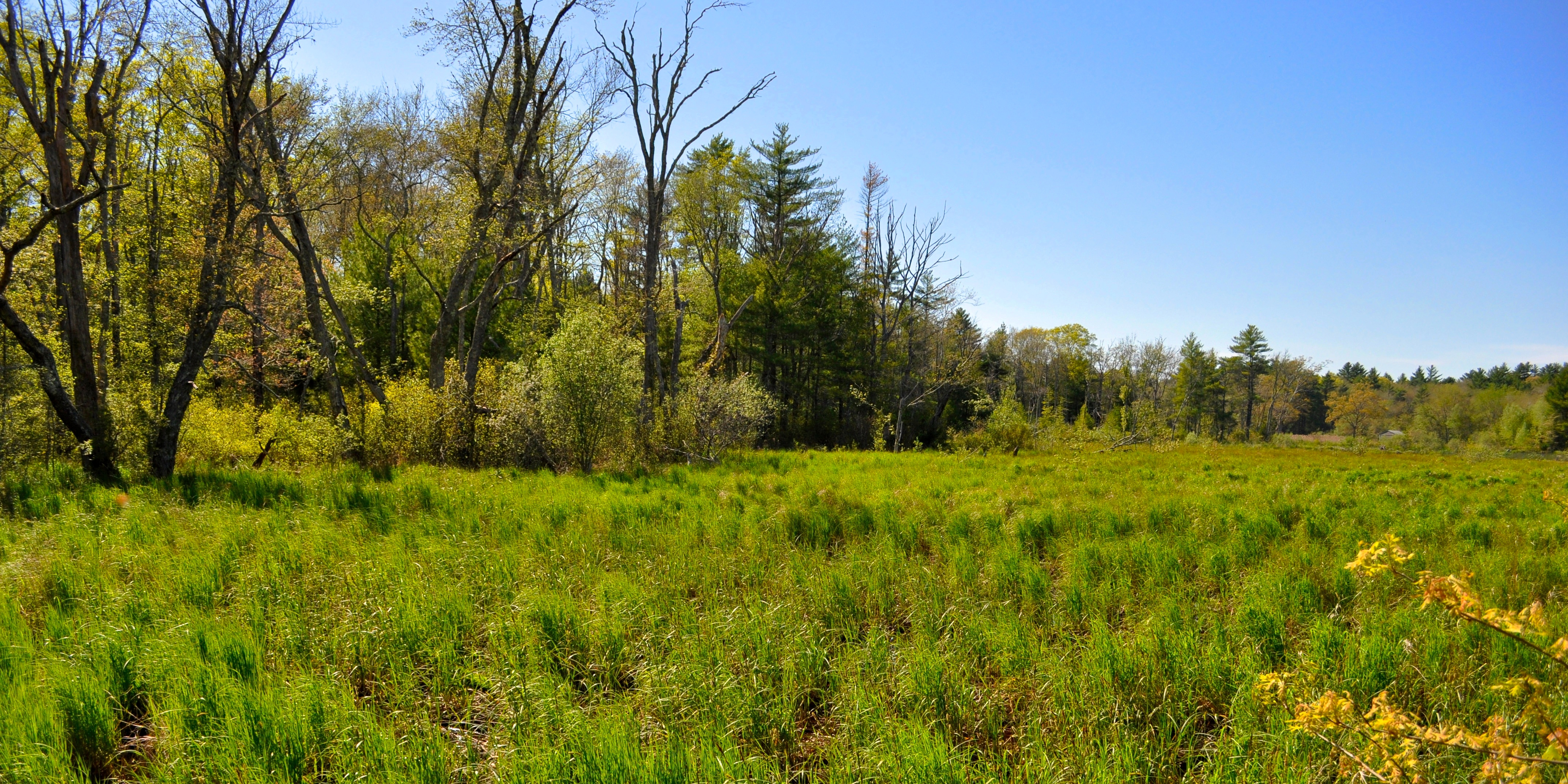
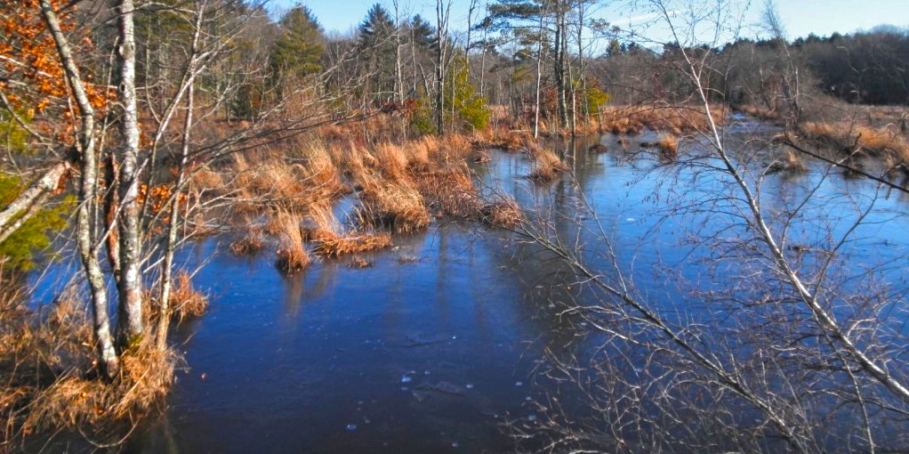
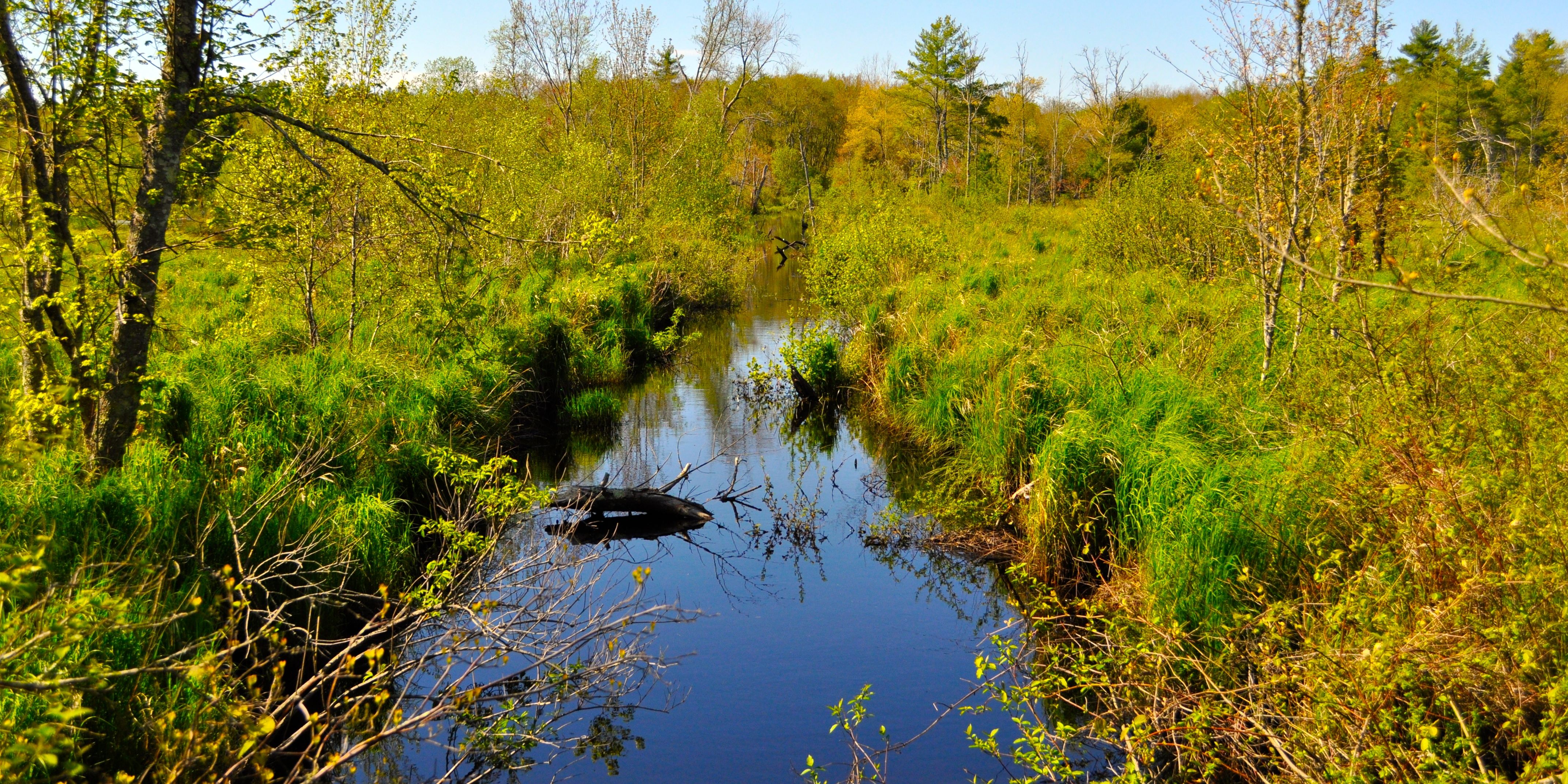
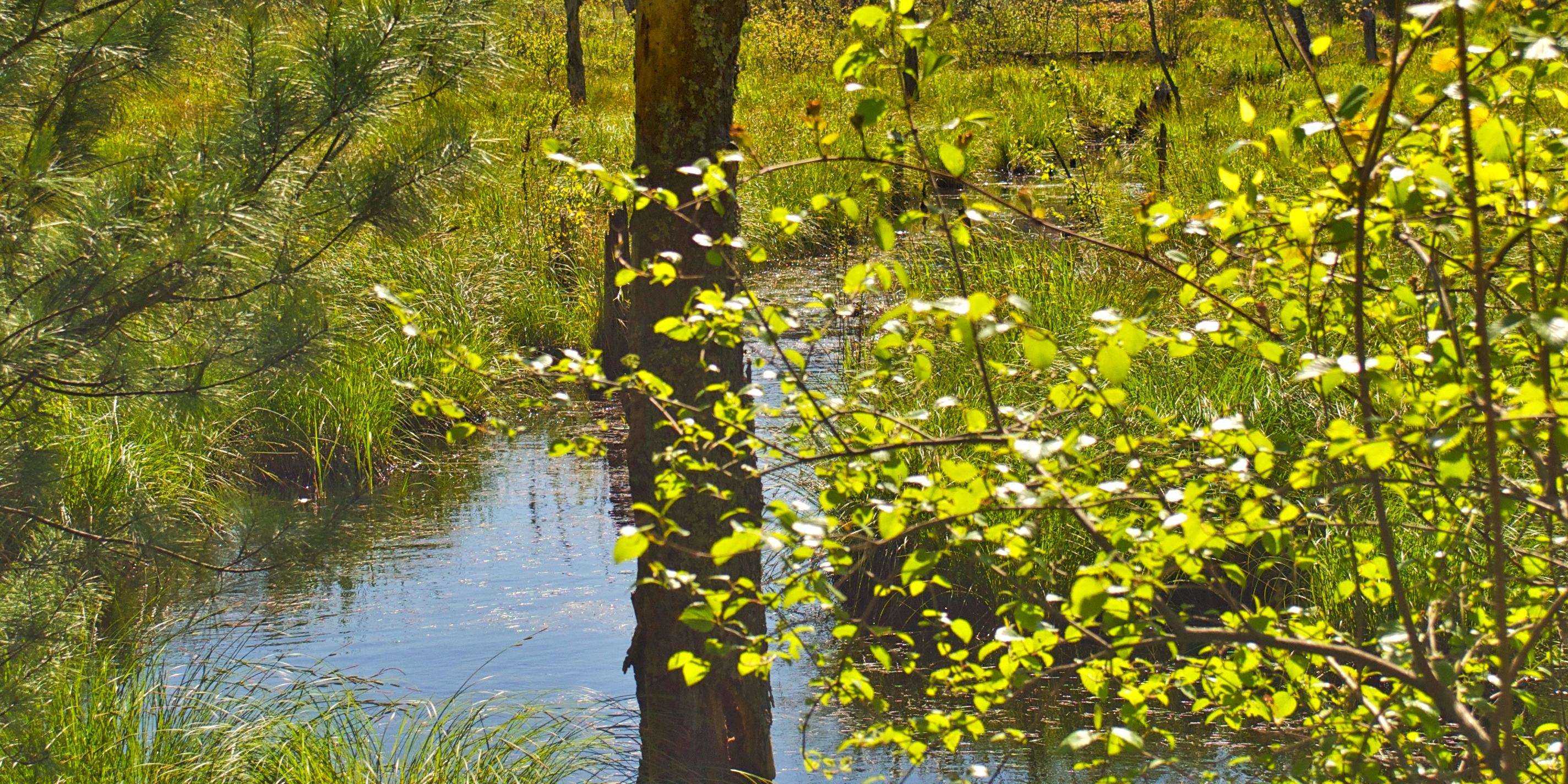
Churchill Park at Jones River Brook, a 11-acre parcel off Main Street (at the intersection of Main St. and Maple St.), will provide non-motorized recreational access to some of the richest natural areas and historical features in Plympton. In Churchill Park, a level trail with occasional benches will circle though the woodlands and connect to a short boardwalk and observation area at Jones River Brook which travels through central Plympton at the rear of the proposed park. From Churchill Park, a future boardwalk over wetlands will provide public access to Cato’s Ridge Conservation Area, the 78-acre town-owned parcel that is currently landlocked. The wetlands and forests in this area are home to many important plant and wildlife species. The Churchill Park property also has historic significance. The property’s ownership dates back to the Churchill family and their descendants, who have lived in Plympton since the Revolution. The Town will partner with volunteers to create a parking area and informational kiosk.
Cato’s Ridge Conservation Area, a 78-acre town-owned parcel that is currently landlocked and sits to the east and northheast of Churchill Park, will be directly accessed from the park. Future plans call for improving this connection with a more expansive boardwalk. Visitors to Cato’s Ridge will be able to explore the area using existing 100-year-old cart paths that spread throughout the property as well as newly created walking trails. And while it may feel like you have been transported to northern New England because of the large old trees and scenic vistas from the 130-foot high Cato’s Ridge, it is also important to note that the Ridge is an important resource for the tows as it covers part of the Plymouth-Carver Sole Source Aquifer and theTown’s two watersheds also meet in this area. The Ridge is named after Cato, a former servant of the Loring family, who is believed to have lived on the Ridge in the Pre-Revolutionary period. Signs of Native American activities also have been reported in this area.
Overview of the two proposed parks and conservation land - this brochure was mailed in April 2012 to all town residents: 2012 PARKS Overview Brochure
A bit about the PARKS
Churchill Park at Jones River Brook, a 11-acre parcel off Main Street (at the intersection of Main St. and Maple St.), will provide non-motorized recreational access to some of the richest natural areas and historical features in Plympton. In Churchill Park, a level trail with occasional benches will circle though the woodlands and connect to a short boardwalk and observation area at Jones River Brook which travels through central Plympton at the rear of the proposed park. From Churchill Park, a future boardwalk over wetlands will provide public access to Cato’s Ridge Conservation Area, the 78-acre town-owned parcel that is currently landlocked. The wetlands and forests in this area are home to many important plant and wildlife species. The Churchill Park property also has historic significance. The property’s ownership dates back to the Churchill family and their descendants, who have lived in Plympton since the Revolution. The Town will partner with volunteers to create a parking area and informational kiosk.
Cato’s Ridge Conservation Area, a 78-acre town-owned parcel that is currently landlocked and sits to the east and northheast of Churchill Park, will be directly accessed from the park. Future plans call for improving this connection with a more expansive boardwalk. Visitors to Cato’s Ridge will be able to explore the area using existing 100-year-old cart paths that spread throughout the property as well as newly created walking trails. And while it may feel like you have been transported to northern New England because of the large old trees and scenic vistas from the 130-foot high Cato’s Ridge, it is also important to note that the Ridge is an important resource for the tows as it covers part of the Plymouth-Carver Sole Source Aquifer and theTown’s two watersheds also meet in this area. The Ridge is named after Cato, a former servant of the Loring family, who is believed to have lived on the Ridge in the Pre-Revolutionary period. Signs of Native American activities also have been reported in this area.
More details
Overview of the two proposed parks and conservation land - this brochure was mailed in April 2012 to all town residents: 2012 PARKS Overview Brochure
THANKS TO ALL OUR PARKS VOLUNTEERS!
The Parks project started in 2011. Since then, over 100 volunteers have given their time and talents to create what we are all enjoying today. Our warmest thanks go to each person who helped make the Parks come to life.
The people below gave extraordinary time and attention to getting the Parks up and running, putting in at least 10 hours, and often much more.
Special thanks to each of them.
Dave Alberti
Vicki Alberti
Bob Andrews
Gail Briggs
Rick Burnet
Jean Cohen
Jay Cohen
Dave Detterman
Judy Dudley
Dan Forand
Chris Lawrence
Linda Leddy
Trevor Lloyd-Evans
Ruud Palenstijn
Frank Perfetuo
Brad Prescott
Christa Prescott
CJ Quinn
Mark Russo
Jane Schulze
Jonathan Shaw
Michelle Smith
Ann Sobolewski
Randy Sullivan
Ted Taranto
Joanne Walsh
Jay Wennemer
Alan Wheelock
Christian Wilhelmsen
Jon Wilhelmsen